Glen Onoko Falls
Photo: Lehigh Valley Railroad Company
(CC via Wikimedia)
 LOWA Renegade EVO GTX MidGORE-TEX, 3 widths, resolableCheck price on Amazon →
 Hydro Flask Wide Mouth 32ozinsulated, durableCheck price on Amazon →
 Osprey Talon 22ventilated back, pole carryCheck price on Amazon →
 Adventure Medical Kits Ultralight Watertight .7day-hike specific, waterproofCheck price on Amazon →
 Black Diamond Spot 400-Rrechargeable, comfortableCheck price on Amazon →
Three waterfalls stacked into a narrow gorge, a lung-burning climb that front-loads 800+ feet of elevation into the first mile, and an overlook that makes you forget you’re in Pennsylvania — Glen Onoko and the Lehigh Gorge Overlook loop is the most dramatic 3-mile hike in the eastern half of the state. It’s also the one most likely to humble you if you show up unprepared.
From the parking area off Route 903 in Jim Thorpe, you’ll head down a set of stairs and under a railroad bridge to reach the trailhead along the Lehigh River. Right away you have a choice: clockwise or counterclockwise. I’ll get into that debate below, but most people — myself included — prefer counterclockwise, which means you’re immediately grinding uphill on the Overlook Trail side.
And “grinding” is the right word. The first mile is essentially a rocky staircase — loose stone, exposed roots, boulders you’ll need to step up onto with both hands sometimes. You’ll gain somewhere between 700 and 1,100 feet depending on which GPS track you trust, and nearly all of it happens before you reach the ridge. Your heart rate will spike. People in solid shape report needing 45 minutes to an hour just for this stretch. If you’re dealing with any cardio limitations, plan on frequent rest stops and don’t feel bad about it — this section is genuinely brutal.
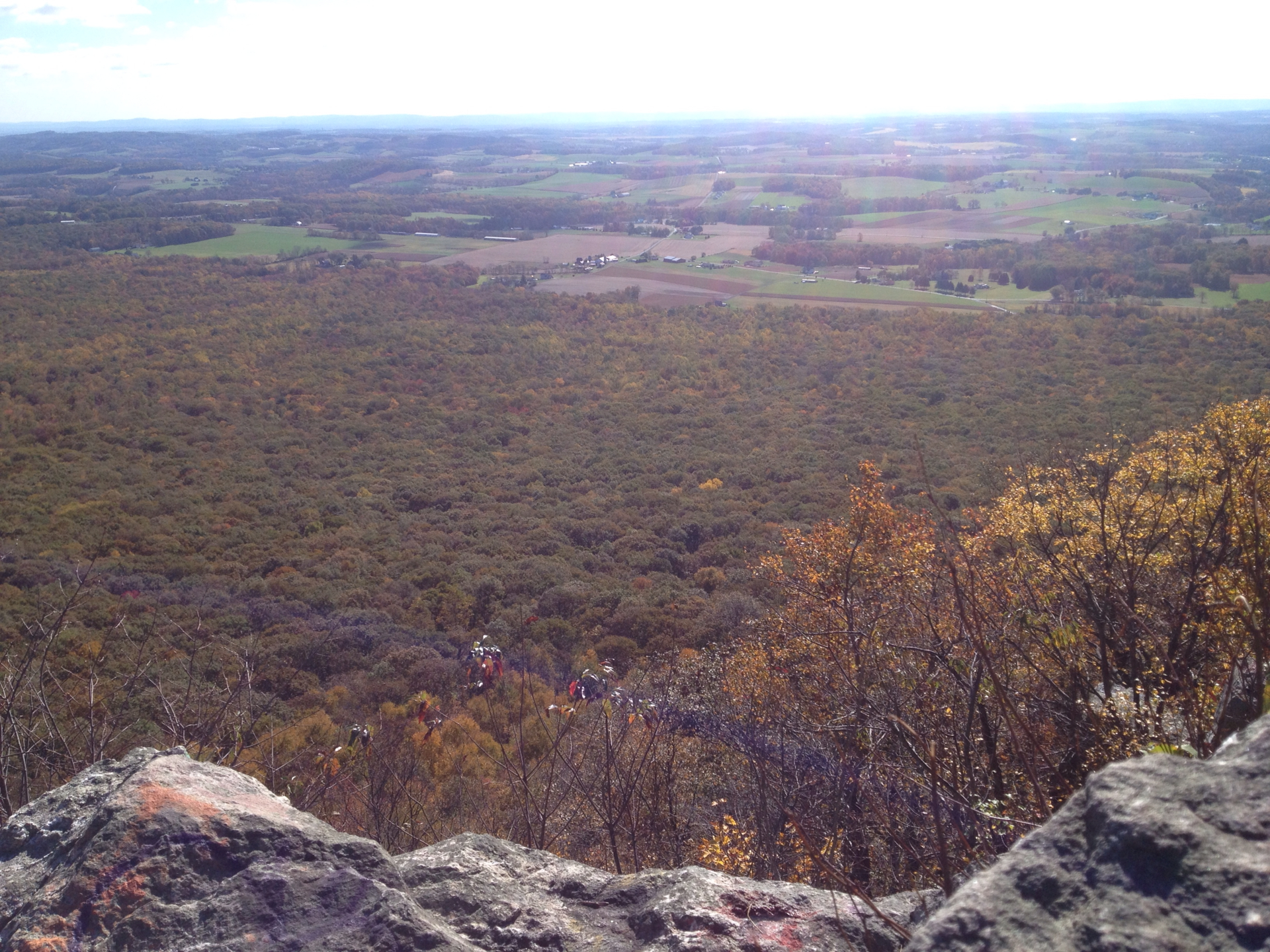
Then the trail flattens out and the reward hits. The main overlook — variously called Hetchell’s Tooth Cliff or the Lehigh Gorge overlook — gives you a wide-open view of the river bending through the gorge with mountains stacking up behind it. On a clear fall day, it’s one of the best vistas I’ve seen in PA. Packer’s Point is another viewpoint along the ridge, though the views there are more obstructed by trees depending on the season. From the overlook, the loop continues along a relatively flat section that eventually transitions to a gravel service road — not exciting, but your legs will appreciate the break. The back half of the loop drops you down toward Cave Falls, a small but fun waterfall you can actually get close to (expect to get splashed), before depositing you back at the trailhead.
The full loop runs about 3 miles and takes most people between 90 minutes and 2.5 hours depending on fitness and how long you linger at the overlooks. Don’t let the short distance fool you — the elevation profile is what makes this hike.
Hard. Not technical-climbing hard, but hard in the way that a relentless rocky incline with poor footing is hard. The first mile is the whole ballgame — after that, it’s a normal walk with some gentle ups and downs. I’ve talked to dozens of people who hiked this trail, and the pattern is always the same: the first mile nearly killed them, and then they were fine. If you can survive 45 minutes of sustained uphill on loose rock, you can do this hike. Good hiking boots are non-negotiable. Sneakers and trail runners will leave you slipping on the descent. Poles help, especially coming down.
Counterclockwise is the move. Going this direction means you tackle the steep, rocky section as a climb rather than a descent — and descending loose boulders is significantly sketchier than ascending them. Clockwise puts the hardest footing on the downhill, which is where most injuries happen. Some people prefer clockwise for the “easier warm-up” from the falls side, but the consensus from everyone I’ve talked to leans heavily counterclockwise. Time-wise, fast hikers finish the loop in 90 minutes. A moderate pace with stops at the overlooks puts you at two hours. Budget more if it’s your first time or if conditions are wet.
Here’s the thing everyone wants to know about. The original Glen Onoko Falls trail — the one that climbs directly up through the gorge past Onoko Falls (25 feet), Chameleon Falls, and the big 60-foot main falls — has been officially closed since 2019. Lehigh Gorge State Park shut it down after multiple fatalities and injuries on the steep, eroded, perpetually wet rock. Signs are posted. Rangers occasionally patrol. As of early 2026, it remains closed with no announced reopening date.
That said — and I’m not telling you what to do here — plenty of people still hike it. The trail isn’t physically blocked off, and a significant number of hikers report going up or down the falls route. The conditions on the closed trail are rough: severely eroded, overgrown in spots, with 45-degree scrambles over loose rock and exposed roots. When it’s wet or icy, it’s genuinely dangerous. The open Overlook Trail loop is the sanctioned alternative, and it gives you access to Cave Falls at the bottom plus the gorge views from the top. You won’t get the dramatic up-close waterfall views of the closed route — you’re essentially above the main falls looking down — but it’s still a great hike on its own merits.
Winter transforms this trail. Snow and ice coat the rocky sections, and mist from the falls (if you venture near them) creates sheets of ice on the surrounding rocks. Microspikes are essential from December through February — multiple hikers have reported the upper sections being genuinely treacherous without them. Poles help too. That said, the frozen falls are stunning if you catch them right, and winter weekdays mean you might have the entire trail to yourself.
Spring brings the best water flow to the falls and Cave Falls, but the trade-off is slippery rock everywhere. The service road section can flood after heavy rain. Mud is a factor on the back half of the loop well into April. If you go after a rainstorm, expect the gorge to be gorgeous but the footing to be miserable — the rock stays slick for hours after the rain stops.
Summer is snake season, full stop. Timber rattlesnakes are a known presence at the rocky overlooks, particularly the first viewpoint you hit going counterclockwise. I’ve heard report after report of rattlesnakes sunning on the exposed rock at Packer’s Point and along the ridge — one person found a whole tangle of them. Copperheads show up too. Watch where you step and where you put your hands. Ticks are aggressive in the tall grass sections, and mosquitoes swarm the lower, shaded portions of the trail. Bug spray is not optional from May through September. Fall is the sweet spot — peak foliage in mid-to-late October turns the gorge views into something special, the bugs die down, the snakes start disappearing, and the rock is generally drier. Weekends during peak leaf season get crowded, though. Weekday mornings are the way to go.
Parking is off Route 903 in Jim Thorpe — there are multiple lots near the trailhead, and on weekdays you’ll have no trouble finding a spot. Weekends and holidays (especially Memorial Day through October) can fill up by mid-morning. Parking is free. Fair warning: there are no bathrooms at the trailhead, and no trash cans either. Handle both of those situations before you arrive. The nearest restrooms and food are in downtown Jim Thorpe, which is about a five-minute drive and worth exploring — good restaurants, historic architecture, a legit small-town vibe. From Philadelphia, plan on roughly two hours of drive time. From New York City, it’s closer to two and a half.
One navigation note: the trail blazing is inconsistent at best. Red blazes mark some sections, but several hikers report losing the trail beyond the overlook area where markings get sparse. Having a downloaded offline map on your phone is smart insurance, especially on the back half of the loop where unmarked spur trails branch off.
After talking to dozens of people who’ve done this trail, the same warnings come up over and over. First: the rattlesnakes at the overlooks. This isn’t a maybe-you’ll-see-one situation — it’s common enough that you should actively scan the rocks before stepping out to any viewpoint. Second: footwear. Every single person who wore anything less than proper hiking boots regretted it. The rock is unforgiving when wet, and even dry it demands ankle support and good grip. Third: water. There’s no source on the trail, the climb is intense, and people consistently underestimate how much they’ll sweat on that first mile. Bring at least a liter per person, more in summer. Fourth: the trail markings. Carry a map. People get turned around, especially where the maintained trail meets the service road and again near the falls spur. And finally — don’t underestimate the descent. Whether you’re coming down the rocky overlook side or the falls side, loose rock and gravity are a bad combination if you’re tired and rushing.
Glen Onoko and the Lehigh Gorge Overlook loop packs more punch per mile than almost anything else within two hours of Philly. The first mile will test you, the overlook will reward you, and Jim Thorpe will feed you afterward. Just bring real boots, watch for rattlesnakes at the viewpoints, and go counterclockwise — you’ll thank me on the way down.
LOWA Renegade EVO GTX MidGORE-TEX, 3 widths, resolableCheck price on Amazon →Hydro Flask Wide Mouth 32ozinsulated, durableCheck price on Amazon →Osprey Talon 22ventilated back, pole carryCheck price on Amazon →Adventure Medical Kits Ultralight Watertight .7day-hike specific, waterproofCheck price on Amazon →Black Diamond Spot 400-Rrechargeable, comfortableCheck price on Amazon → Patagonia Torrentshell 3L Jacketdurable, trail + everydayCheck price on Amazon →
 Darn Tough Hiker Micro Crew Midweightlifetime warrantyCheck price on Amazon →
 Black Diamond Pursuit Trekking Polescork grip, lightweightCheck price on Amazon →
 Sawyer Squeeze Water Filterultralight, standard threadsCheck price on Amazon →
 Sawyer Premium Permethrin Insect Repellent Spraytreat clothing; kills ticksCheck price on Amazon →
 Mountain Hardwear Crater Lake Long Sleeve HoodyUPF 50, hood + thumb holesCheck price on Amazon →